



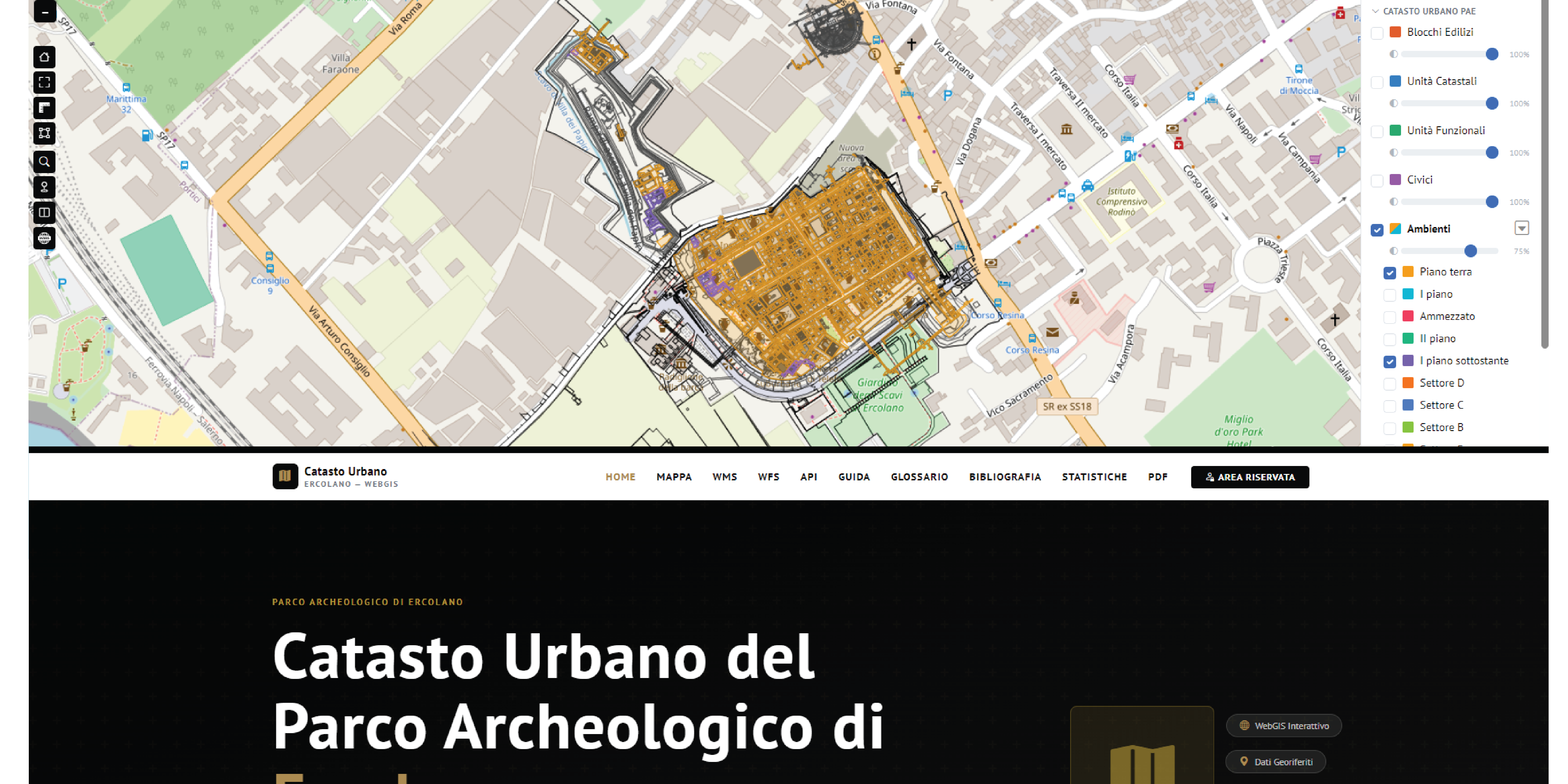
An open and interactive digital platform, featuring Open Data and geoservices, designed to explore the site through city blocks, complexes, functions, and individual spaces.
The Herculaneum Archaeological Park makes the ancient city’s Urban Cadastre available to the public. It is a cataloging and mapping system that allows visitors to understand the archaeological site through its spatial organization: from city blocks and architectural complexes down to the spaces designated for various activities and individual rooms. It is an open and interactive digital platform, created for the protection and maintenance of the site and now available to everyone to foster a shared understanding of our cultural heritage.
The Land Registry is the result of a long process of research, review, and updating that began in 2006. It was developed as part of the collaboration—now spanning more than two decades—between the Herculaneum Archaeological Park and the Packard Humanities Institute, through its operational arm in Italy, the Packard Institute for Cultural Heritage.
“The Urban Land Registry makes knowledge—originally developed for the protection and maintenance of the site—accessible to everyone. Publishing the data in an open format means sharing this heritage with scholars, professionals, and citizens, in line with the commitment to transparency already established through Ercolano Digitale. It is another step toward a park that is increasingly open and accessible to the public,” says Federica Colaiacomo, Director of the Herculaneum Archaeological Park.
The result is an interactive map of the urban layout of Herculaneum, built using thousands of georeferenced elements and organized into four interconnected layers:
- Building Blocks, corresponding to city blocks;
- Cadastral Units, which identify complexes of buildings and spaces belonging to the same property or the same building complex;
- Functional Units, which bring together spaces related to a specific function;
- Environments, that is, individual spaces.
The platform includes the excavated area of the ancient city, the Villa dei Papiri, and the Ancient Theater. It offers various tools for exploring the heritage:
- an interactive WebGIS map, with access to historical photos and images of the site’s decorative elements;
- a group of layers dedicated to historical cartography;
- textual data and chronologies of 20th-century excavations;
- numerical statistics on the extent of the archaeological and architectural heritage;
- a user guide, a glossary of architectural and urban planning terms, and a basic bibliography;
- a copy of the Land Registry in PDF format.
The portal uses the same design as the Park’s official website and is intended for a broad audience, as well as for professionals in the field.
Data accessibility is particularly significant. The information is published as Open Data and can be accessed and queried using open digital tools and standards, via APIs and WMS and WFS geoservices. With these tools, anyone can create their own map of Herculaneum, continuing the tradition of transparency and sharing already established by Ercolano Digitale. This approach also ensures that the data is constantly updated as new information becomes available in the years to come.
“The online publication of the Urban Land Registry is another step forward in the joint effort—now spanning more than two decades—between the Park and the Packard Humanities Institute, driven by a shared vision of strengthening the fundamental resources needed for the comprehensive and dynamic management of the archaeological site,” says architect Jane Thompson, manager of the public-private partnership on behalf of the Packard Foundations.
Technology and knowledge thus come together in a project that makes the urban complexity of Herculaneum more accessible and transforms years of study and documentation into a shared digital heritage. Exploring the Land Registry means entering the ancient city with a fresh perspective: not merely visiting its monuments, but understanding its structure, functions, and the relationships between its spaces.
An unparalleled digital infrastructure: no other park or cultural heritage agency has all of the following available online in one place: artifacts, 3D models, point clouds, an interactive map, historical photos, decorative elements, and statistics. And a portal dedicated to maintenance will be launched soon.
The Urban Land Registry is freely available online: https://sigerc.herculaneum.org/catasto/